November 8 – World Urbanism Day
The identity of a city refers to a multi-layered, cumulative, and dynamic structure that encompasses the social values, sociological tendencies, beliefs, values, and habits of its inhabitants..
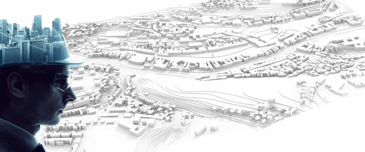
November 8 – World Urbanism Day
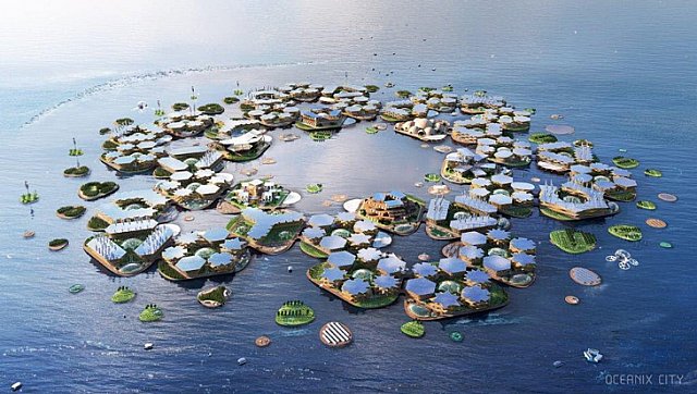
World Urbanism Day is a special day aimed at raising awareness in the field of urban planning and increasing public interest and participation in city life. First introduced in 1949 by Professor Carlos Maria della Paolera, this concept emphasizes that urbanization should be approached not only by architects but also through the collaboration of various disciplines. Celebrated annually on November 8 across four continents and more than 30 countries, World Urbanism Day provides a platform to address issues shaping the future of cities, including sustainability, accessibility, green space density, public transportation efficiency, housing challenges, and cultural richness.
‘Planning in the New Century’, 47th World Urbanism Day Colloquium
This year in Turkey, the colloquium organized to celebrate World Urbanism Day carries the theme "Planning in the New Century," coinciding with the 100th anniversary of the Turkish Republic. The event provides an opportunity to discuss urban planning projects and future-oriented strategies.
Many topics will be addressed under headings such as “Cities and living spaces resilient to natural events,” “Regional planning in the new century,” “Institutional structure of planning (legislation, plan production processes, and administrative structure),” “Planning profession, actors, processes, and opportunities; digital transformation in planning,” “Local governments, participation, and democracy; urban space and accessibility,” “Heritage and urbanism: what we have lost and what we will transfer to the new century,” “Justice in space/society and urban policy,” “Urban design practices and quality urban spaces in the new century,” “Ecology, urbanization, and rural areas in the Anthropocene era,” and “Demographic mobility in cities: challenges, problems, and opportunities.” These subjects will be explored by distinguished academics and experts during the 47th World Urbanism Day Colloquium, held in Ankara’s Gençlik Park from November 8-10, 2023, hosted by Ankara Metropolitan Municipality. Speakers include valuable academics from Middle East Technical University, Yıldız Technical University, Mimar Sinan Fine Arts University, and Karadeniz Technical University, as well as esteemed members of the TMMOB Chamber of Urban Planners. The colloquium is expected to shed light on urban planning approaches for the next century of the Turkish Republic.
A Brief History of Urbanism
The identity of a city refers to a multi-layered, cumulative, and dynamic structure encompassing the social values, sociological tendencies, beliefs, values, and habits of its inhabitants. The history of urbanism has evolved alongside human history, demonstrating a dynamic interplay shaped by the rise and fall of civilizations. In ancient times, the first settled communities emerging after the agricultural revolution typically chose locations based on geographical advantages. Ancient civilizations such as Egypt, Mesopotamia, India, and China focused on water sources, agricultural productivity, and trade routes in their urban planning. In Ancient Greece, the orderly city planning proposed by Hippodamos marked a significant advancement in urbanism.
During the Middle Ages in Europe, cities often became centers of the feudal system, while in the Renaissance, aesthetic and artistic values were emphasized in urban design. The Industrial Revolution spurred rapid city growth, necessitating the development of infrastructure, housing, and public transportation systems. Today, urbanism continues to shape the future of cities by addressing sustainability, accessibility, green spaces, public transportation, housing, use of public areas, urban transformation, and cultural richness. Cities develop unique plans based on their culture, history, geography, and demographics. Urban plans both shape and are shaped by the identity of societies. Plans are designed and evolve to serve the population's needs over time, though wars, natural disasters, or migrations may lead to complete replanning or systematic changes. Expert planners’ competence, forward-looking vision, and intellectual foundation are crucial for making these decisions.
Examples of Urban Planning in World Metropolises
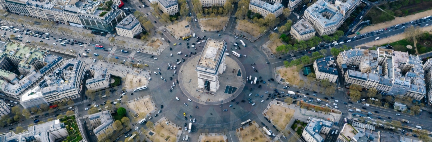
Paris City Plan
Paris features one of the most remarkable city plans. The city center, which has undergone multiple transformations over history, is characterized by wide boulevards, parks that enhance social interaction, and excellently landscaped green spaces. In addition to an efficient public transportation network, the city’s architectural heritage significantly shapes its identity.
The city center, stretching along both banks of the Seine, includes key landmarks like Notre-Dame Cathedral and the Ile de la Cité, considered the “heart of Paris.” Famous for its wide romantic boulevards, iconic cafés, and bustling streets, Paris underwent major urban renewal in the 19th century under Georges-Eugene Haussmann. Narrow streets were replaced with broad boulevards arranged in a radial pattern, with the Arc de Triomphe at the center of Charles de Gaulle Square. This radial layout emphasized public gathering spaces and facilitated security interventions. Boulevards such as Champs-Elysées and Boulevard Haussmann remain famous examples.
Large parks and well-organized green spaces such as Bois de Boulogne, Bois de Vincennes, Parc des Buttes-Chaumont, and Jardin des Tuileries add significant value to the city. The transportation network—metro, buses, trains, bicycle lanes, and pedestrian paths—ensures accessibility and encourages active social participation. Paris’s rich history, culture, and architectural heritage, including Gothic, Renaissance, Baroque, and Neoclassical structures, contribute to its established identity. Iconic landmarks like the Louvre Museum, Eiffel Tower, Sacré-Cœur Basilica, and Palace of Versailles exemplify this heritage, making Paris a globally recognized tourist destination with a unique atmosphere.
Tokyo City Plan
Tokyo, the capital of Japan, is one of the world’s largest metropolises. Its complex and layered city plan reflects a combination of history, natural conditions, modernization, and population density. Tokyo’s origins trace back to the Edo period, while modern Tokyo emerged during the Meiji Restoration in the late 19th century. The city later became the seat of Japan’s central government.
The city center includes districts such as Chiyoda, Chuo, Minato, and Shinjuku, hosting business centers, government buildings, financial institutions, luxury shopping areas, and residential zones. Tokyo is known for its skyscrapers and observation towers like Tokyo Tower and Tokyo Skytree. The metropolis is divided into 23 wards, each with its local government and unique characteristics.
Despite its complex layout, Tokyo has an efficient transportation network, including JR East, Tokyo Metro, and Toei Subway systems, along with Narita and Haneda airports connecting it to other major cities. Natural disasters, particularly earthquakes and tsunamis, have heavily influenced city planning, leading to resilient and well-engineered infrastructure. Tokyo’s city plan, shaped by high population density, technological advancements, and cultural diversity, supports its role as a major center of culture, commerce, and finance.
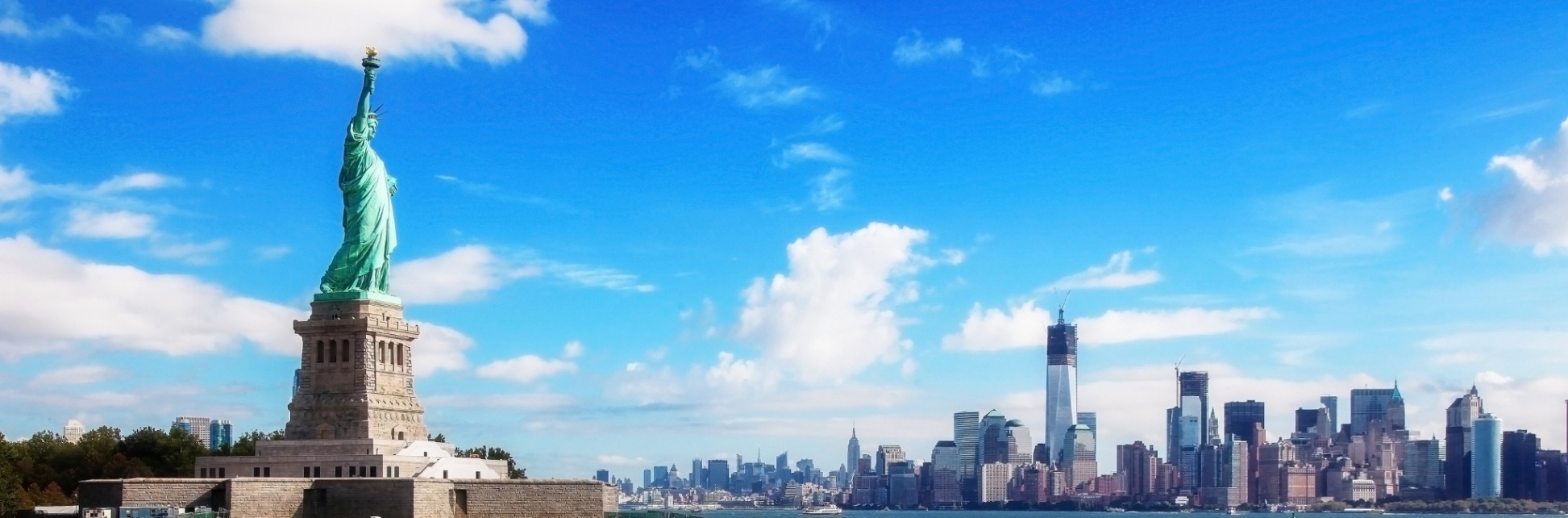
New York City Plan
New York, one of the largest and most iconic cities in the United States, is instantly recognizable even to those who have never visited, thanks to Hollywood films. Manhattan, Central Park, and other symbolic structures define its image.
New York’s city plan is based on a grid system, with Manhattan serving as the main island. Established under the Commissioners’ Plan of 1811, the grid features straight, sequential streets and avenues for easy navigation. Times Square, at the intersection of 7th Avenue, Broadway, and 42nd Street, represents the city’s core. Manhattan hosts key business centers like Rockefeller Center, Fifth Avenue, and the Financial District, including Wall Street. Central Park, designed in 1857, provides a large green space with lakes, sports areas, and recreational zones, alleviating urban density pressures and fostering social life.
Surrounded by waterways such as the Hudson River, New York’s port and maritime traffic shaped its historical development. The city comprises five boroughs—Manhattan, Brooklyn, Queens, The Bronx, and Staten Island—which merged in 1898 to form its current boundaries. Iconic skyscrapers like the Empire State Building, One World Trade Center, and Chrysler Building define the skyline. Diverse neighborhoods such as Harlem, Chinatown, Little Italy, SoHo, and Greenwich Village attract both locals and visitors. A vast public transportation network—including subways, buses, and ferries—supports daily mobility.
New York’s urban plan reflects the dynamics of a constantly evolving and expanding metropolis, shaped by economic, cultural, and historical influences, offering numerous opportunities for exploration to both residents and visitors.
Discover